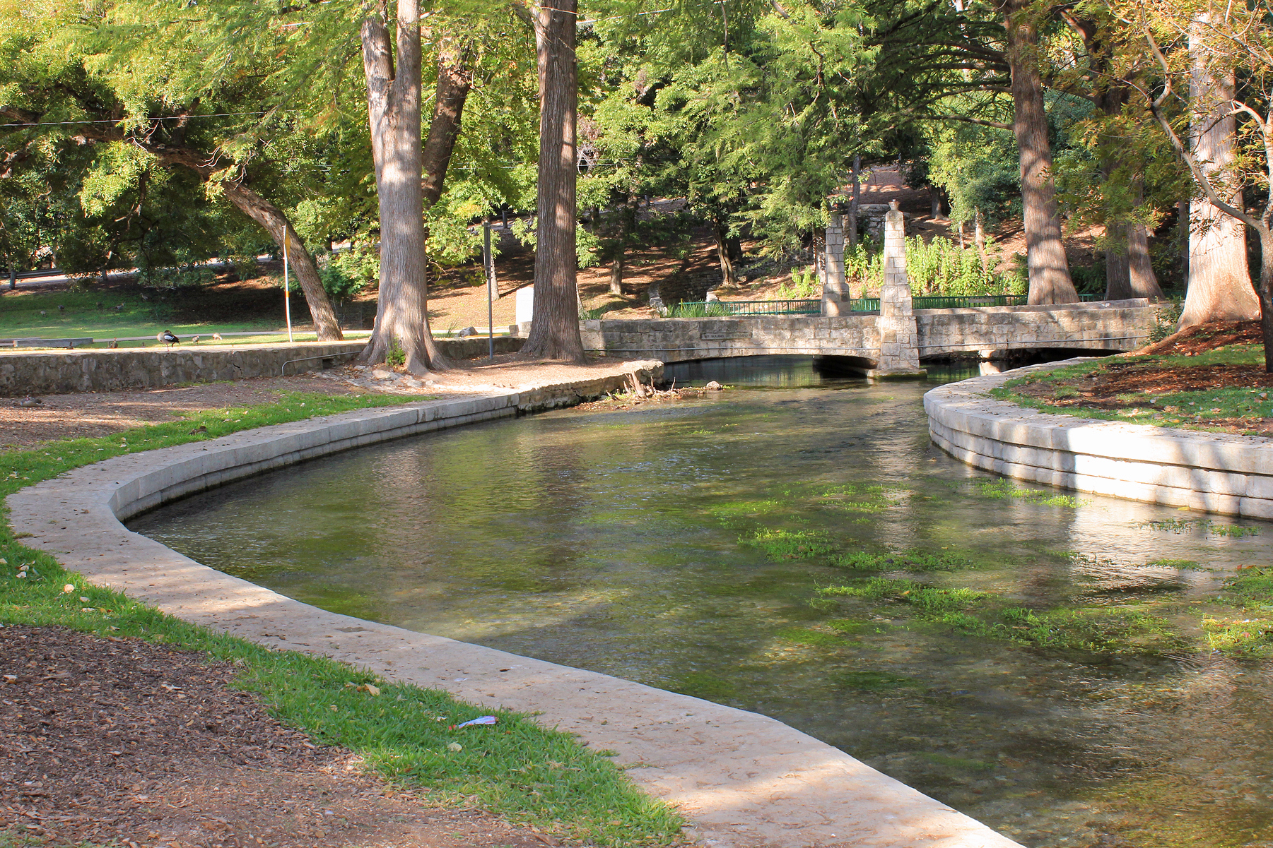
The familiar local timeline begins with German wagons reaching the Comal in March 1845. That is a useful date for the founding of New Braunfels. It is a terrible date for beginning the history of the place.
The water was here before the town.
The Comal Springs and the Guadalupe corridor made this landscape useful long before Europeans named or surveyed it. Texas historical sources identify Tonkawa and Waco people as among the principal Native inhabitants in the region on the eve of German settlement, with Lipan Apache and other peoples also moving through the wider area. These were not empty lands waiting for a town.
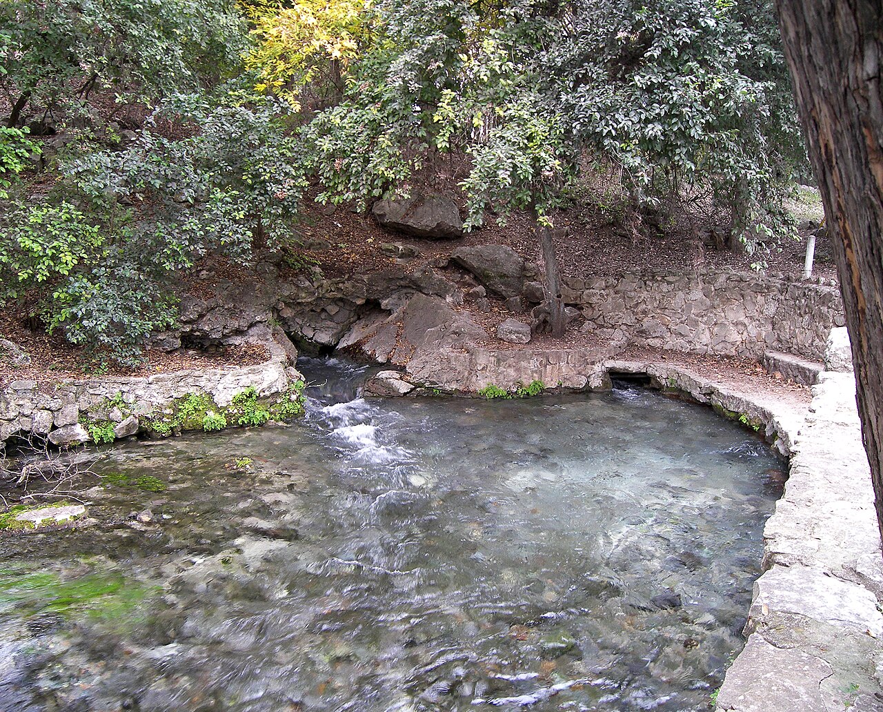
Spanish and Mexican Texas came next.
The corridor sat within Spanish Texas and later independent Mexico. Land ownership around the Comal was tied to the Veramendi family before the Adelsverein acquisition. That earlier legal history did not simply vanish when Germans arrived; disputes over the Comal tract continued for decades.
Then 1845—and a new demographic force.
The German migration was transformative. But treating it as creation-from-nothing hides the political and human landscape into which those immigrants entered. The more accurate story is one of succession, negotiation, displacement, adaptation and memory.
What to notice when you visit.
- At the Comal, think about water as the reason people repeatedly chose this place.
- At heritage sites, notice where the interpretive timeline begins—and what falls outside it.
- When a plaque says “settled,” ask what legal, Indigenous or Mexican history preceded that act.
Water organized movement before municipal borders
Comal Springs and the Guadalupe corridor offered water, food resources, travel routes and places of recurring use. Indigenous presence should not be framed as a brief preface that ends when European documents become abundant.
Spanish and Mexican rule changed claims, not human attachment
Imperial jurisdictions, missions, ranching and land grants introduced new legal systems and conflicts. Mexican-era land history is essential to understanding how later settlers acquired and described the landscape.
Names can conceal earlier geographies
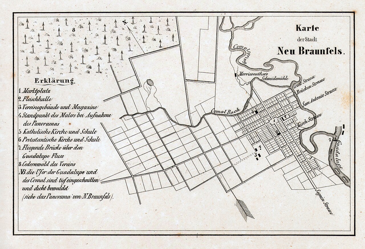
“New Braunfels” begins a municipal chronology, not the history of the place. Starting the story in 1845 privileges the arrival of one group and makes everyone else appear peripheral. The springs offer a better opening because they connect environmental and human history across political periods.
How to visit responsibly
At Landa Park, look first at water and terrain rather than monuments. Ask why people returned to this location and how later development changed access. Avoid presenting Indigenous peoples only in the past tense; descendant communities and living cultures remain.
Evidence is uneven
Archaeology, environmental history, Spanish and Mexican records, later recollections and Indigenous knowledge do not offer equal coverage or the same perspective. Gaps in the written archive often reflect colonial power rather than an absence of people or activity.
Use names carefully
Tribal identities, political alliances and territorial use changed over time. Avoid presenting a single people as the permanent owner of a fixed modern boundary. The responsible claim is that multiple Indigenous communities used and understood this landscape long before New Braunfels existed.
Water explains the earlier geography
Comal Springs and the Guadalupe were travel corridors, ecological resources and meeting places long before they became recreation brands. The abundance of spring water helps explain repeated human use of this ground. A date on a city seal cannot mark the beginning of history; it marks the beginning of one political settlement.
How to stand in the story
Walk at Comal Springs without treating the landscape as untouched wilderness. Look for the relationship among spring openings, higher ground and routes outward. Then visit the museum archives, where maps and artifacts can add evidence. The interpretive discipline is simple: acknowledge what is documented, name uncertainty and do not turn Indigenous nations into a timeless preface.
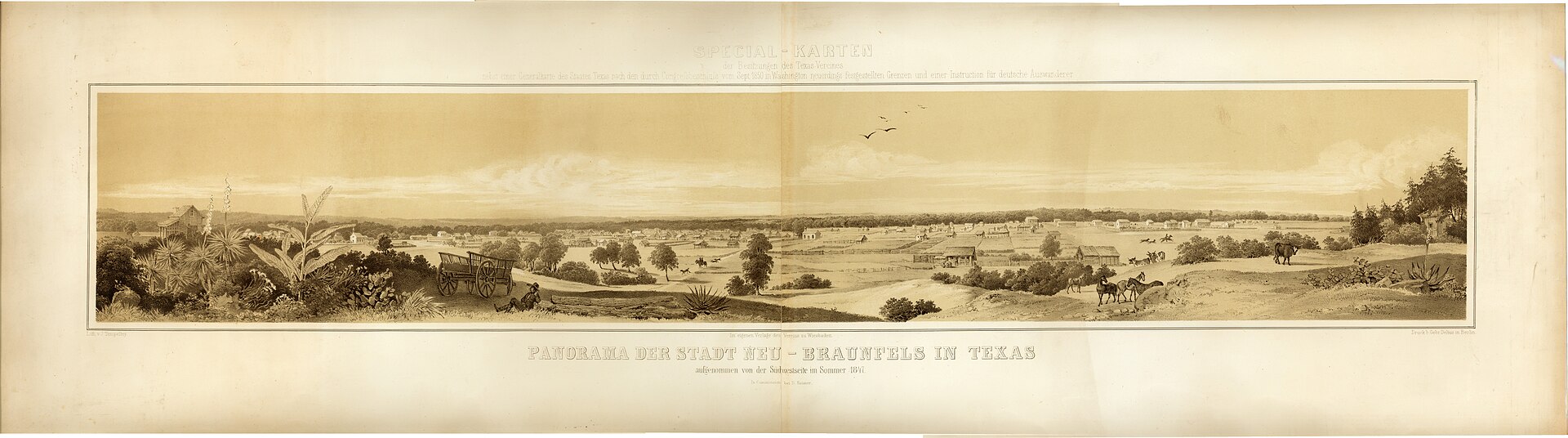
The 1847 panorama begins after the beginning
The famous early panorama of Neu-Braunfels is useful because it shows how quickly the immigrant town imposed a new geometry on the landscape: streets, roofs, cultivated ground and civic order. It is also useful for what it cannot show. By the time the drawing was made, the German settlement had already become the visual subject, while the Indigenous and Mexican histories that made the place intelligible were pushed outside the frame. Historical images are evidence, but they are never neutral windows.
Read the springs as infrastructure, not scenery
Comal Springs made repeated settlement possible because dependable water supported people, plants, animals and movement. The Spanish name, the Mexican land system and the later German town each placed a different political vocabulary over the same hydrology. A visitor who begins with the water can hold those periods together instead of treating them as separate themed rooms.
Tony’s read: Landa Park is often presented as recreation with history attached. Reverse that order. It is an ancient water landscape that later became industrial power, municipal parkland and tourism infrastructure. The picnic tables are recent; the reason people kept returning is not.
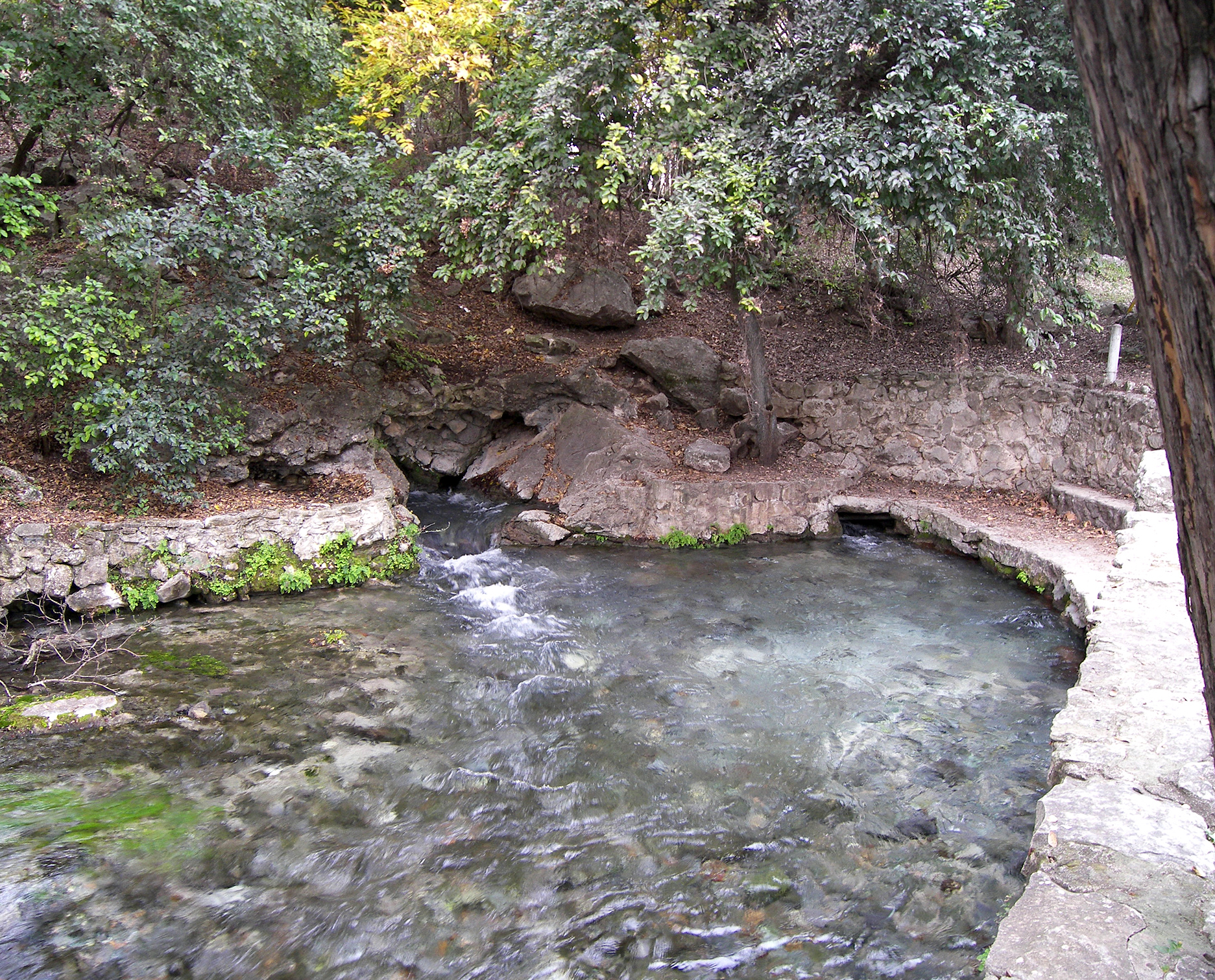
History does not begin with a town charter
Comal Springs and the Guadalupe created a durable human landscape long before German colonization. Water, game, plants, stone and routes through the Balcones Escarpment drew Indigenous peoples across generations. Nations and communities changed through time; they should not be compressed into a single timeless “Native” preface. Archaeology, colonial records and tribal histories provide different kinds of evidence, each with limits.
Spanish and Mexican sovereignty added missions, ranching, roads, military movement and land grants to an already inhabited region. Political boundaries changed faster than the landscape. By 1845, the ground selected for New Braunfels carried older routes, claims and memories. German settlers did not enter empty wilderness, even when promotional literature described opportunity in those terms.
How to interpret the springs responsibly
At Landa Park, look first at hydrology: spring openings, elevation, dependable flow and routes outward. Then ask how each society used and understood the place. Avoid staging photographs on sensitive ground or presenting reconstructed certainty where the evidence remains incomplete. The responsible story acknowledges continuity, disruption and the survival of Indigenous nations beyond the city’s founding narrative.
Why I make that choice
The springs, Indigenous presence and Spanish and Mexican land history are not a ceremonial preface to German settlement. I begin at the water because it explains why people chose this ground long before anybody called it New Braunfels.
A route with a fallback
Realistic time60–90 minutes at Comal Springs plus reading
Field methodBegin at the water, then use museum or archival interpretation
FallbackIf heat or mobility limits the walk, use the overlook and indoor records
Open the field map · Follow the whole-story route · Find a current public program
Sources & further reading
- Texas State Historical Association — Comal County
- Texas State Historical Association — Veramendi Estate
- Texas State Historical Association — New Braunfels, TX
Tony’s Guide separates documented history from interpretation. If you spot an error or know of a primary source we should examine, send a correction.