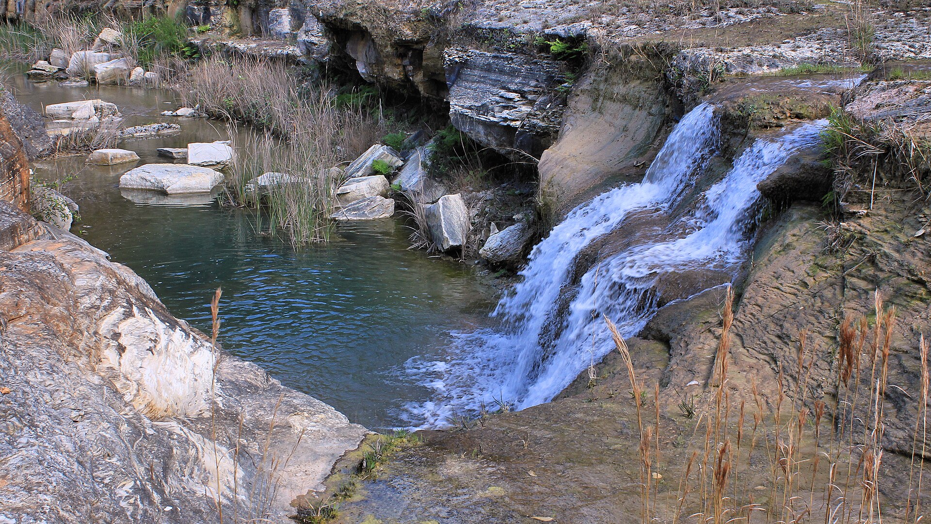
Canyon Lake Gorge looks ancient—and the rock is—but the visible gorge is a modern exposure. During the July 2002 flood, water passed over the Canyon Dam spillway and tore through limestone, soil and vegetation, revealing bedrock, fossils and the physical structure of the Hill Country.
The event compressed an enormous amount of erosion into days. That makes the gorge scientifically dramatic, but it should not be described as if the entire canyon was created from nothing in one flood. The flood exposed and excavated an older geological record.
Why the limestone matters
Central Texas limestone controls how water moves above and below ground. Fractures and soluble rock contribute to springs, caves and aquifer systems. At the gorge, layers and erosional features can be read at human scale. Fossils and trackways place the rock in a history vastly older than the reservoir, the town or the river’s recreational identity.
The 2002 flood and the spillway
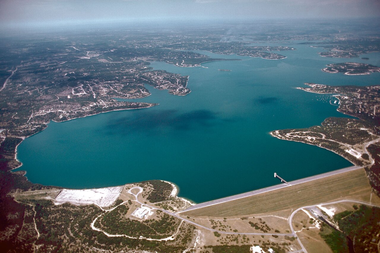
Canyon Dam reduces downstream flood risk, but a reservoir has limits. In 2002 the lake rose into the spillway, and the escaping water excavated the gorge. The landscape is therefore evidence of both the dam’s protective purpose and the magnitude of water that the system must manage.
Access is controlled
The gorge is not an unrestricted trail where visitors should improvise routes. Guided opportunities and operating arrangements change. Confirm the current program, reservation requirements, physical demands and weather policy before traveling. Do not enter closed areas, remove fossils or assume that a map pin grants access.
Who should go
Go if geology, floods, fossils, hydrology or the history of Canyon Dam interest you. It is especially strong for older children and adults willing to listen, move carefully and accept a structured visit. Skip it if the group expects casual swimming, unrestricted wandering or a quick roadside attraction.
Build a coherent geology day
- Begin at the Canyon Dam overlook to understand the engineered system.
- Visit the gorge only through current authorized access.
- Continue below the dam to see the Guadalupe as a managed downstream river.
- Finish at the Heritage Museum of the Texas Hill Country for additional fossil and track context.
Accessibility and heat
Gorge terrain can involve uneven rock, exposure and limited shade. Ask the current operator about distance, elevation, surfaces and rest opportunities. A visitor who cannot take the tour can still understand the system from the dam overlook and museum exhibits. In warm months, water, sun protection and an early schedule are essential.
Fossils are evidence, not souvenirs
The exposed limestone contains fossils and traces of environments that existed when this part of Texas lay beneath a shallow sea. Their value comes from location and context: the layer, surrounding rock and relationship to other evidence. Removing an object destroys part of that context and may violate site rules. Photograph, ask questions and leave the material where it belongs.
What the gorge teaches about flood language
Visitors often hear “hundred-year flood” and imagine a schedule. The term describes probability, not a waiting period. The gorge offers a physical correction to that misunderstanding. Extreme water can reorganize terrain quickly, and flood-control structures reduce risk without abolishing it. The 2002 event belongs beside the region’s 1972 and 1998 flood histories, not apart from them.
Pair geology with present conditions
Before the visit, open the live-conditions page and note Canyon Lake elevation, recent precipitation and Guadalupe flow below the dam. Those numbers connect the static rock record to the working water system. At the overlook, identify the dam, conservation pool and spillway. Below the dam, observe how a controlled release becomes the recreational Guadalupe.
What children should understand
The strongest lesson is not that one flood “made a canyon.” It is that old rock, moving water, weather and engineering interact on radically different timescales. A child who can distinguish the age of the limestone from the age of the exposed gorge has learned more than someone who simply collected photographs.
The flood was an event; the rock records deep time
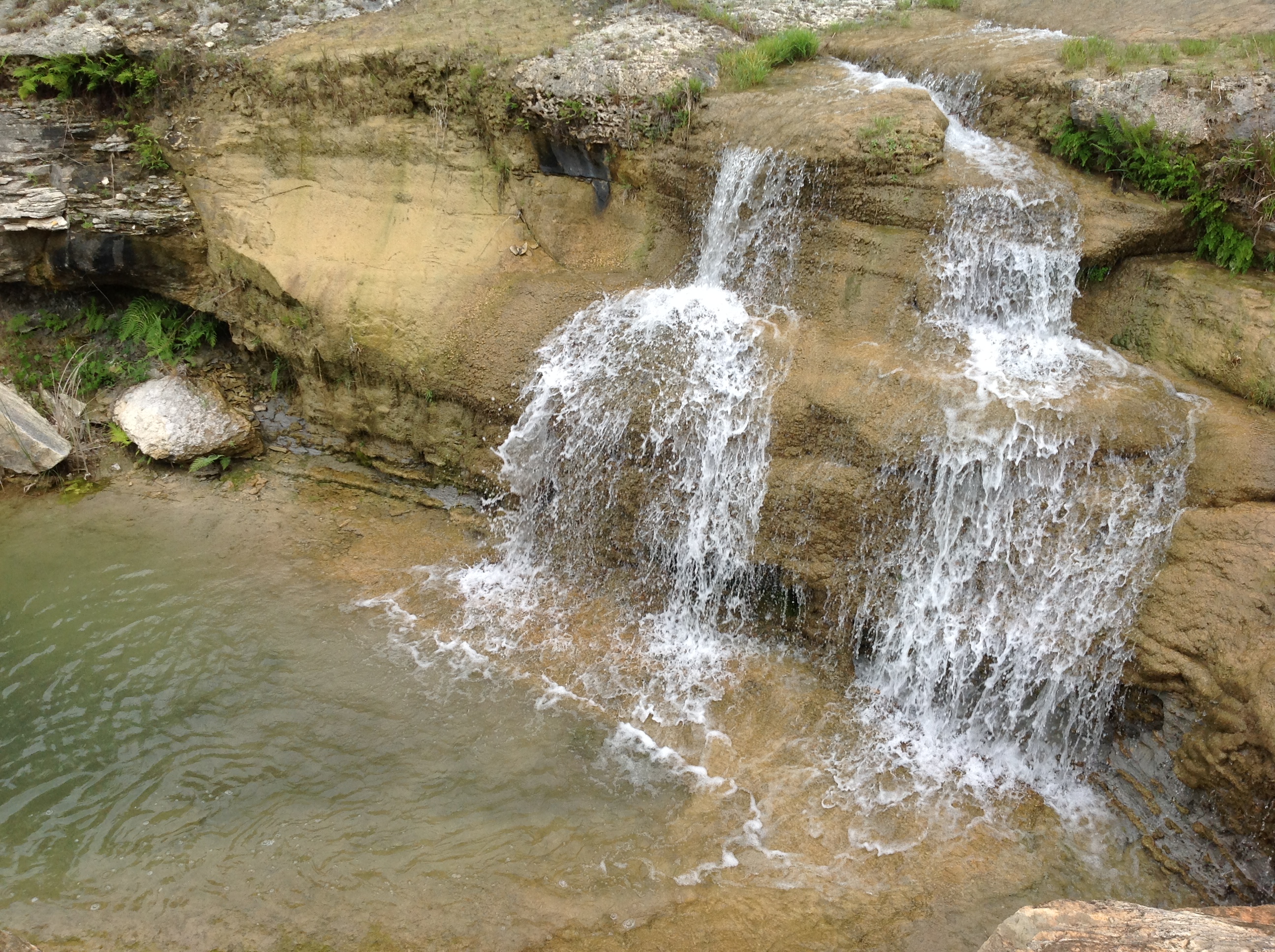
The 2002 flood did not create the limestone layers, fossils or ancient channels. It removed soil and vegetation rapidly enough to expose them. That distinction matters. The gorge is simultaneously a modern disaster landscape and a window into Cretaceous geology formed when this part of Texas lay beneath a shallow sea.
The spillway is part of the lesson
Visitors sometimes describe the gorge as if floodwater simply escaped the lake. In fact, water crossed the emergency spillway after the reservoir rose beyond normal operations. The resulting flow excavated a new channel and demonstrated why engineers distinguish routine outlet releases from exceptional spillway flow.
Tony’s read: See the dam and spillway before the gorge tour if possible. The engineering context makes the exposed geology more legible, while the gorge makes flood terminology less abstract. Check current tour rules; controlled access protects visitors and the resource.
The flood opened a geological archive
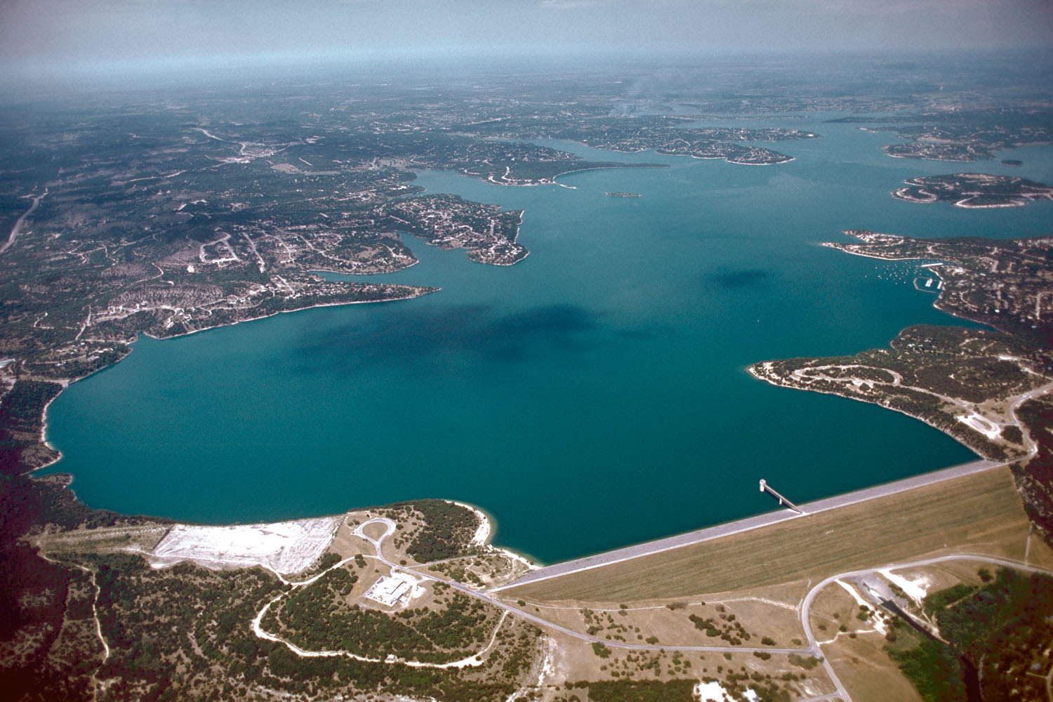
In 2002, floodwater passed over the Canyon Lake spillway and cut through soil and limestone, exposing a gorge that reveals layers, fossils, channels and the power of moving water. The event was sudden on a human timescale, but the rock records environments vastly older than the reservoir and the dam.
The gorge should not be described as a natural canyon merely discovered by visitors. It is a flood-created exposure associated with engineered infrastructure. That distinction is the interpretive key: geology, hydrology and public works meet in one landscape.
Why guided access matters
Protected fossils, uneven ground, heat and the need to preserve evidence make controlled access reasonable. A guided visit can distinguish ripple marks, biological traces and later erosion from casual visual guesses. Stay on the route and leave every object in place. Removing a fossil or stone destroys context even when the object appears small.
Why I make that choice
Without the geology and flood story, the gorge can become another dramatic backdrop. I am here to understand what the exposed limestone records, not to defeat a railing or turn a protected landscape into a shortcut.
A route with a fallback
Realistic time2–4 hours
Field methodReserve guided access and let geology—not photography speed—set the pace
FallbackUse the dam overlook and interpretive material if tours or weather do not align
Open the field map · Follow the whole-story route · Find a current public program