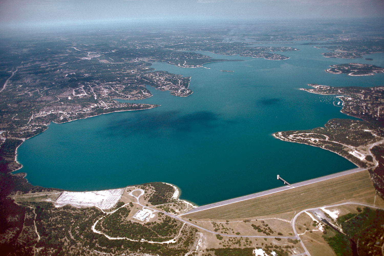
On a map, Canyon Lake appears to be one destination: a broad blue reservoir northwest of New Braunfels. On the ground, it behaves like several loosely connected places. Peninsulas divide the shoreline. Public land interrupts private development. Roads approach coves without circling the water. Community names overlap postal addresses, and the Guadalupe enters on one side and leaves below the dam on another.
Open the complete live water report for the Comal, downstream Guadalupe, weather, raw gauges and my current interpretation.
The organizing fact: this is a federal reservoir
Canyon Dam was completed in 1964. Impoundment began that year, the lake was dedicated in 1966 and reached conservation pool in 1968. The Corps of Engineers manages the reservoir for flood-risk reduction, water supply and other public purposes; recreation grew around that engineered landscape. The normal conservation pool is 909 feet above mean sea level. That is a management reference, not the depth of the lake and not a guarantee that every ramp or cove is usable.
The project receives runoff from a large upper-Guadalupe watershed. When the lake is above conservation pool, the Corps evaluates elevation, inflow, forecasts and downstream flooding before releasing water. The Guadalupe-Blanco River Authority and the Corps jointly control outflow. This is why lake elevation and the Sattler flow gauge belong together: one describes stored water; the other describes the release-influenced river immediately below the dam.
The federal shoreline produces an experience unlike a privately built resort lake. Public parks, wildlife habitat, flowage easements, marinas and residential neighborhoods meet at irregular boundaries. A house may be near Corps land without having a private dock. A visible cove may have no legal public path.
Sattler and the eastern gateway
Sattler is the practical hinge between FM 306, River Road, the below-dam Guadalupe and the eastern lake. It is not a traditional downtown, but it functions as a service center for groceries, outfitters, fuel and food. Choose this corridor when the trip mixes river time, Whitewater-area music, the dam and an eastern-shore base.
South shore and Startzville
The south side is the easiest lake relationship for visitors also spending time in New Braunfels and Gruene. Comal Park provides major day-use recreation when open. Startzville acts as a recognizable south-shore community and commercial reference point. The advantage is regional access; the weakness is assuming every south-shore rental is close to the same gate or usable shoreline.
Map Comal Park Map Startzville
North shore: Canyon City, Hancock and broad-water orientation
The north side suits visitors who want the lake to dominate the trip. Canyon Park and north-shore neighborhoods provide access to broad water, while the Hancock area preserves a place name older than the reservoir. Driving back to Gruene or downtown is entirely possible, but it should not be treated as a casual walkable extension.
Map Canyon Park Map Hancock Trail
West shore: Cranes Mill and Potters Creek
Cranes Mill lies near the Guadalupe’s entry and carries the name of an older valley community. Its park and marina make the west side legible for campers and boaters. Potters Creek, farther north, is a developed Corps campground with a designated swim area for registered campers. These are strong bases for people who value camping and water access over frequent city trips.
Map Cranes Mill Map Potters Creek
Fischer, Spring Branch and the outer Hill Country
Fischer sits west of the lake as a historic rural community rather than a waterfront district. Spring Branch lies beyond the immediate lake edge and connects travelers toward Highway 281 and Guadalupe River State Park. These places matter because Canyon Lake tourism depends on a broader road-and-service geography than the shoreline alone.
Map Fischer Map the state park
The road system determines the trip
FM 306 is the principal east-west service corridor. FM 2673 carries much of the south-side traffic. River Road is scenic and intimate but should not be treated as the fastest connection. Roads across or near the dam orient the eastern shore. There is no simple lake loop. A ten-mile straight-line separation can require a much longer drive around water and public land.
Public access versus waterfront appearance
The Corps and local operators provide parks, ramps, campgrounds and overlooks, but access changes with gates, seasons, capacity and lake elevation. A closed ramp is not necessarily a closed park; a park with water views is not necessarily a swim beach. Use the specific facility page and current conditions, not a generic map label.
Four trips that actually work
- Lake sampler: dam overlook, one south-shore park and dinner back toward New Braunfels.
- Camping trip: Potters Creek or Cranes Mill, with supplies purchased before settling in.
- River-lake trip: Sattler, below-dam Guadalupe access and the dam/gorge landscape.
- Quiet geography trip: Fischer, west-shore roads, Cranes Mill and a slow return through the Hill Country.
What I would not do
I would not book by the words “Canyon Lake” alone. I would not tow a boat without checking the precise ramp. I would not promise swimming because a property has a water view. And I would not combine a full lake day, Gruene shopping, downtown history and San Marcos into one itinerary. Geography is not an obstacle to defeat; it is the structure of the experience.