West climbs into limestone. East opens into oil country.
New Braunfels sits close to a geographic hinge. A day on the road can move from spring-fed valleys and cedar hills to cotton towns, pumpjacks and the flatter country toward Luling.
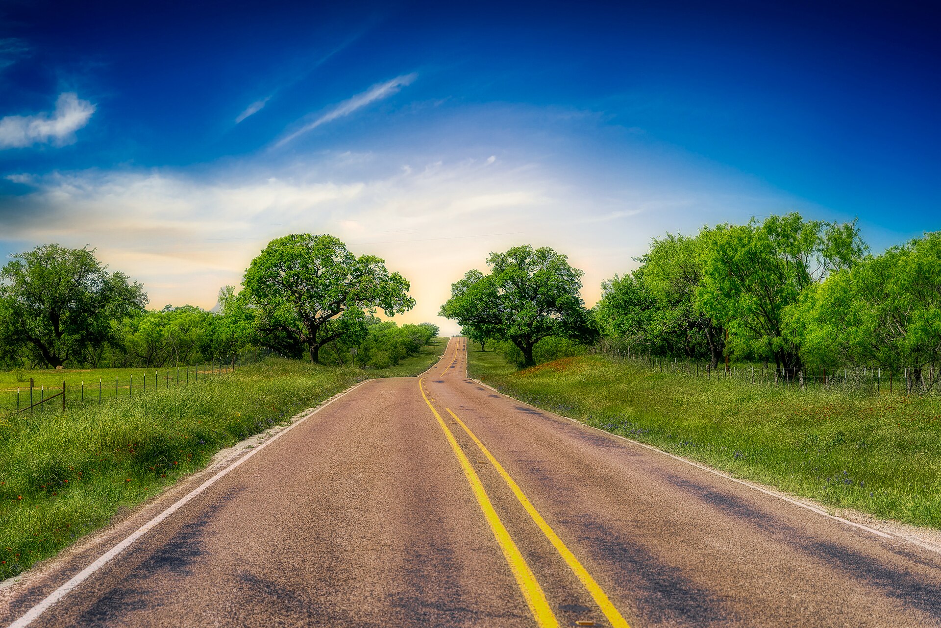
A Hill Country back road. The road is not empty space between attractions; it is the experience. Photo: GPA Photo Archive, CC BY 2.0.
MAP THE DRIVE
Four road choices, drawn on the map
Compare actual road paths, stop order and the travel time before stops. Open current driving directions when you leave.
The essential local loop. River Road stays close to the Guadalupe; Sattler reveals the service center behind the recreation economy; the dam explains why Canyon Lake exists. Stop only where access and parking are legal.
Creeks, limestone ridges, live oaks, courthouse squares and changing elevation. Wimberley can absorb hours; Blanco adds the old courthouse and river park. Do not turn this into a windshield marathon.
Build the drive around The Salt Lick rather than treating it as an errand. The changing road, ranch land and oak cover are what make the meal feel like a destination.
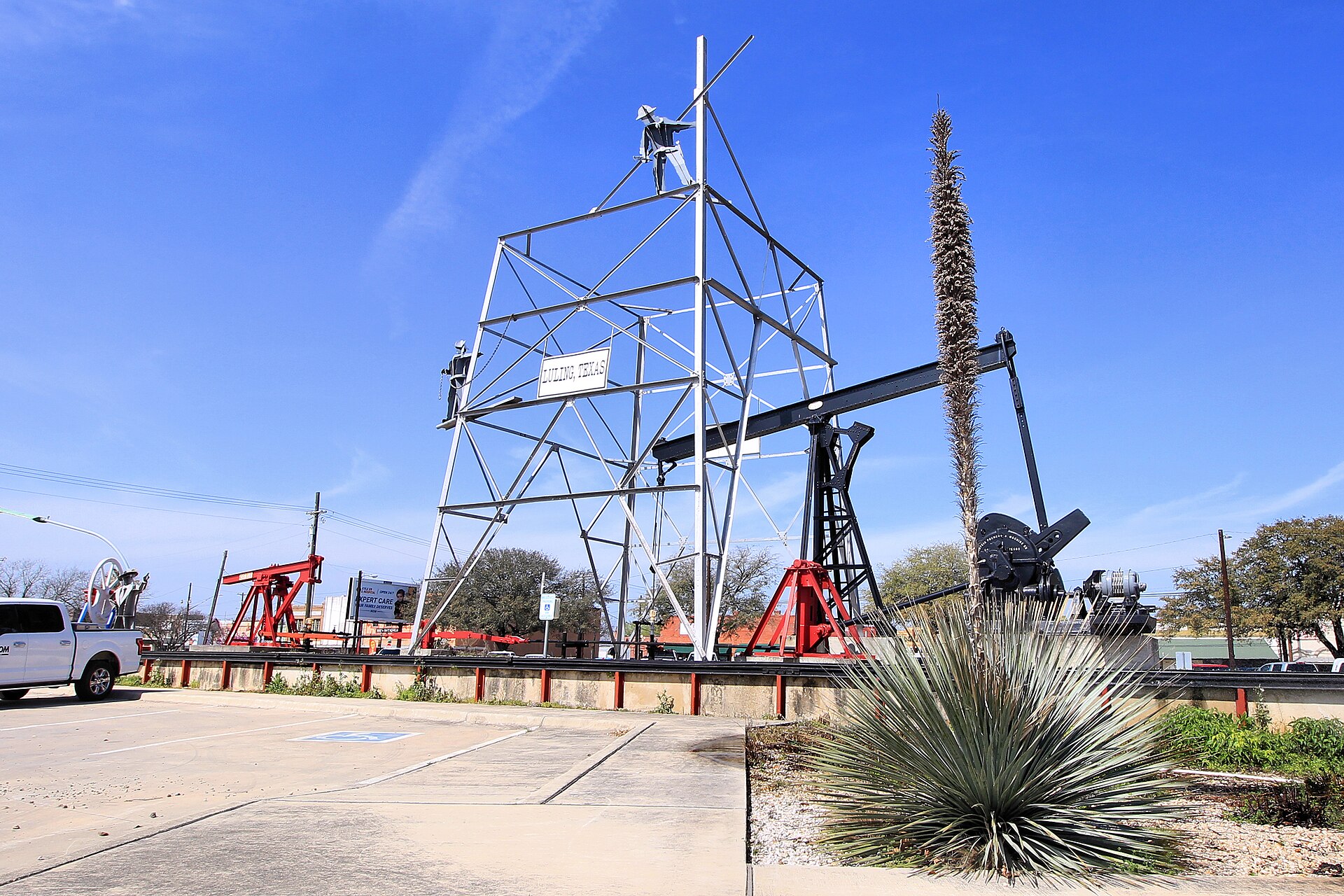
Cross the Balcones Escarpment and the landscape loosens. Seguin brings the Guadalupe, pecan country and civic history. Luling makes the oil economy visible in working pumpjacks and whimsical decorated “Pumpjack Zoo” figures, then connects it to a celebrated barbecue tradition.
The Hill Country can be magnificent on a bicycle, but “scenic” does not mean forgiving. Narrow shoulders, blind rises, cattle guards, loose gravel, fast traffic, heat and long distances between services all matter. River Road is visually tempting and can be poor riding at crowded times. Weekday mornings, cooler seasons and routes vetted by local cycling organizations are the intelligent choice.
Casual riderChoose protected greenways, park loops or quiet in-town riding. Landa Park and selected New Braunfels connections are better than improvising on ranch roads.
Experienced road riderUse a published local route, carry more water than seems necessary, share your plan and verify current pavement and construction.
Gravel riderAccess changes. Do not assume a road is public because a mapping app draws a line through it.
Mountain-bike dayUse a purpose-built trail system or state park where bicycle use is explicitly allowed; check closures after rain.
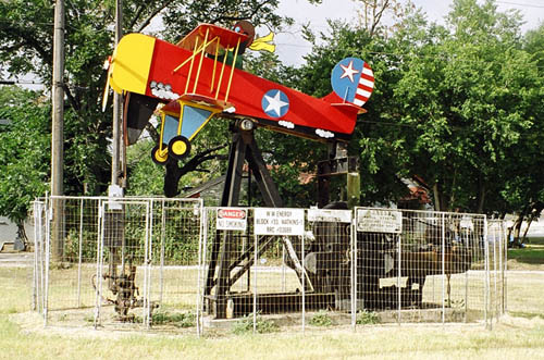
Luling changes the story. A decorated pumpjack from the town’s oil landscape. This particular figure has since been removed; the Pumpjack Zoo tradition remains the point. Larry D. Moore, CC BY 4.0.
How to read the Hill Country
The “hills” are the dissected eastern and southern edge of the Edwards Plateau. Limestone, thin soils, springs and flash-flooding shape the roads. West and northwest of New Braunfels, water cuts into rock. East toward Seguin and Luling, the terrain transitions toward prairie and agricultural country, while railroads, cotton and oil become more visible in the built landscape. That contrast is why a drive east can teach as much as the postcard route west.
Tony’s rule: One long road, one serious stop, one meal. A Hill Country day fails when the itinerary treats every town as a collectible.
The road is not empty space between attractions
Hill Country roads reveal the region’s geology and settlement pattern: limestone cuts, creek bottoms, ranch gates, live-oak uplands and small crossroads communities. They also carry commuters, school buses, cyclists, farm equipment and wildlife. A scenic drive succeeds only when the driver treats the road as shared infrastructure rather than as a moving overlook.
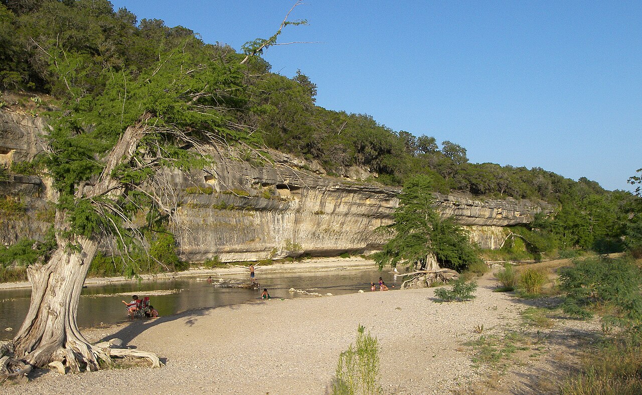
The Guadalupe valley’s limestone and river corridor make the drive part of the visit. Photo: Larry D. Moore · CC BY 4.0.
River Road follows the Guadalupe closely and can be narrow, crowded and vulnerable to high water. Roads around Canyon Lake are indirect because coves and the dam interrupt straight travel. Routes toward Fischer, Wimberley, Blanco and Spring Branch climb and turn through a different landscape than the I-35 corridor. Travel time matters more than mileage.
Oil is public memory here. Luling’s identity is built into the streetscape, not confined to an industrial edge.
Build one loop, not a web
Select one destination beyond the main base and one return route. A Gruene–River Road–dam loop can work when conditions are good. A north-shore drive toward Fischer can work as a quieter landscape day. A barbecue detour should be the anchor, not an addition after several other long drives. Repeatedly crossing the region converts scenic travel into fatigue.
Road ethics
Do not stop on blind curves, block ranch entrances or trespass for a better frame. Turn around at water-covered pavement. Give cyclists lawful space. Slow down near wildlife at dawn and dusk. The landscape is not a set built for visitors; it is where people live and work.
Four drives with different purposes
River Road: water, cliffs and recreation culture, best when crossings and traffic are quiet. Dam to Sattler: engineering, the gorge and practical lake orientation. North shore to Fischer: ranch roads, limestone uplands and a smaller-community scale. New Braunfels to San Marcos: springs, settlement and the rapidly urbanizing I-35 corridor.
Choose one. Start with fuel, water and a saved destination. Download the route if coverage is uncertain. Tell someone when a rural detour is part of the day, especially when traveling alone. Scenic driving should reduce urgency, not create it.
Photography without hazard
Use established parks, overlooks and business stops. A beautiful limestone cut or oak tunnel is not a safe shoulder. Do not stand in the roadway, climb fences or turn into a private drive to reverse direction. The photograph is never worth forcing another driver into an emergency maneuver.
Read the transition
The strongest drive is not necessarily the one with the most dramatic overlook. Watch how a commercial corridor gives way to pasture, how cedar thickens on limestone slopes, how a creek crossing attracts older settlement and how subdivisions redraw former ranchland. Those transitions explain contemporary Hill Country pressures—water, traffic, habitat and growth—better than a scenic label alone. The road becomes an interpretive route when the traveler notices what is changing as well as what is beautiful.
Why I make that choice
I stop where access is legal, leave ranch entrances alone and turn around at water-covered pavement. The landscape rewards attention; it does not require trespassing or a dangerous photograph.
Plan the experience
Essential, full and fallback
Realistic time3–7 hours
Cost postureFuel and meals; most landscape viewing is free
Access realityCurves, wildlife, cyclists, low-water crossings and weak signal
Essential
Drive one loop with two established stops
Full
Add one small town or reserved meal without backtracking