1 · Water before town
Comal Springs and Landa Park
Go early. Read the springs as Indigenous geography, municipal water, industrial power and public recreation—not simply as a pretty park.
Come for the rivers if you like. But understand the springs, mills, streets, churches and neighborhoods, and New Braunfels becomes a far more interesting city than the version sold on souvenir shirts.
By Tony DePass · Field guide edition · Reviewed September 2026
New Braunfels makes the most sense when you stop treating its history as a single German story. The German settlement is essential—one of the defining migrations in Texas history—but it took shape beside waters used for thousands of years, on land governed by Spain and Mexico, within a region of Indigenous travel, exchange and conflict. The city that followed was built by merchants, mill workers, craftspeople, farmers, domestic workers and railroad laborers; by Black congregations and Mexican-American families as well as German institutions.
That fuller history is not hidden in some distant archive. It is under your feet at Comal Springs, in the street pattern around Main Plaza, in the old mill district, in the churches east of downtown, in West End memory and in cemeteries that preserved names public narratives often ignored. The useful question is not “What German things should I see?” It is “Why did a city form here, who built it, and whose New Braunfels do I see today?”
The Comal is short, spring-fed and urban. The Guadalupe is longer, larger and more variable. They are often bundled together in visitor advertising, but historically they did different work. Comal Springs made this a dependable place to live and gather long before a town called New Braunfels existed. The Guadalupe linked the site to older travel corridors; the Spanish expedition of Domingo Terán de los Ríos followed El Camino Real through this country in 1691, crossing near the later Faust Street Bridge corridor.
The place moved through Spanish and then Mexican jurisdiction. In 1825, the Mexican government granted the land around the springs to Juan Martín de Veramendi. Remember that sequence. “Founded in 1845” marks the creation of the German town, not the beginning of human history here.
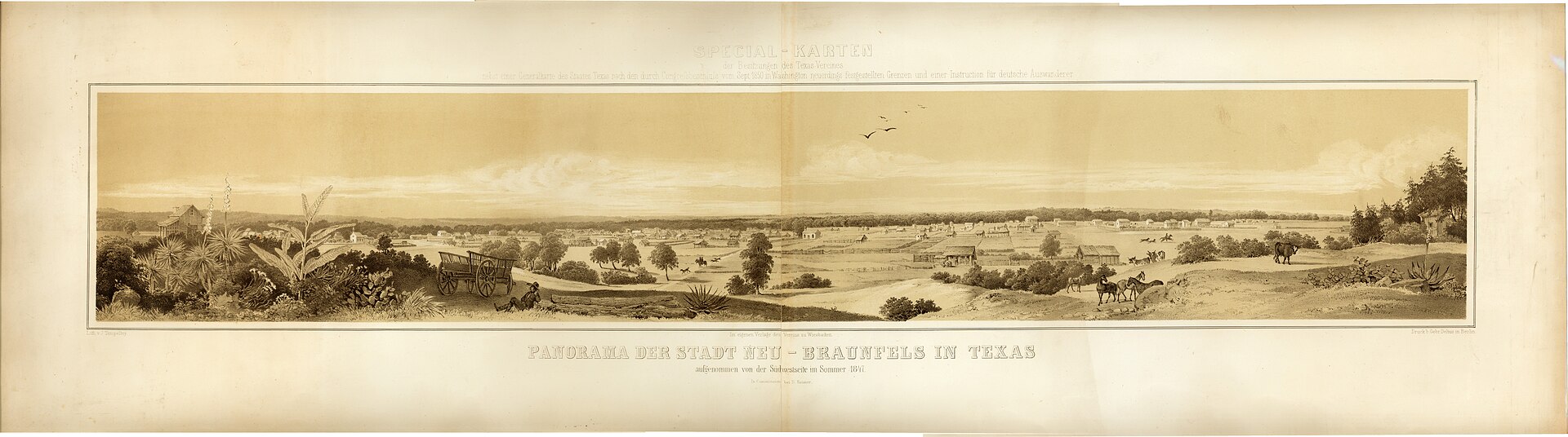
Prince Carl of Solms-Braunfels came to Texas for the Adelsverein, the Society for the Protection of German Immigrants in Texas. The society’s colonization ambitions pointed farther west, but the practical problem was immediate: immigrants needed a secure stopping place between the coast and the society’s land grant. In March 1845, Prince Carl purchased the roughly 1,265-acre Comal tract from the Veramendi heirs. The first settlers crossed the Guadalupe on Good Friday, March 21.
The story is often softened into a cheerful founding legend. It was harder than that. The Adelsverein was badly organized and financially overextended. Later immigrants were stranded on the coast; disease, inadequate transportation and shortages killed hundreds. New Braunfels survived not because an aristocratic plan worked smoothly, but because settlers built institutions, farms, businesses, schools, churches and mutual-support networks after the plan faltered.
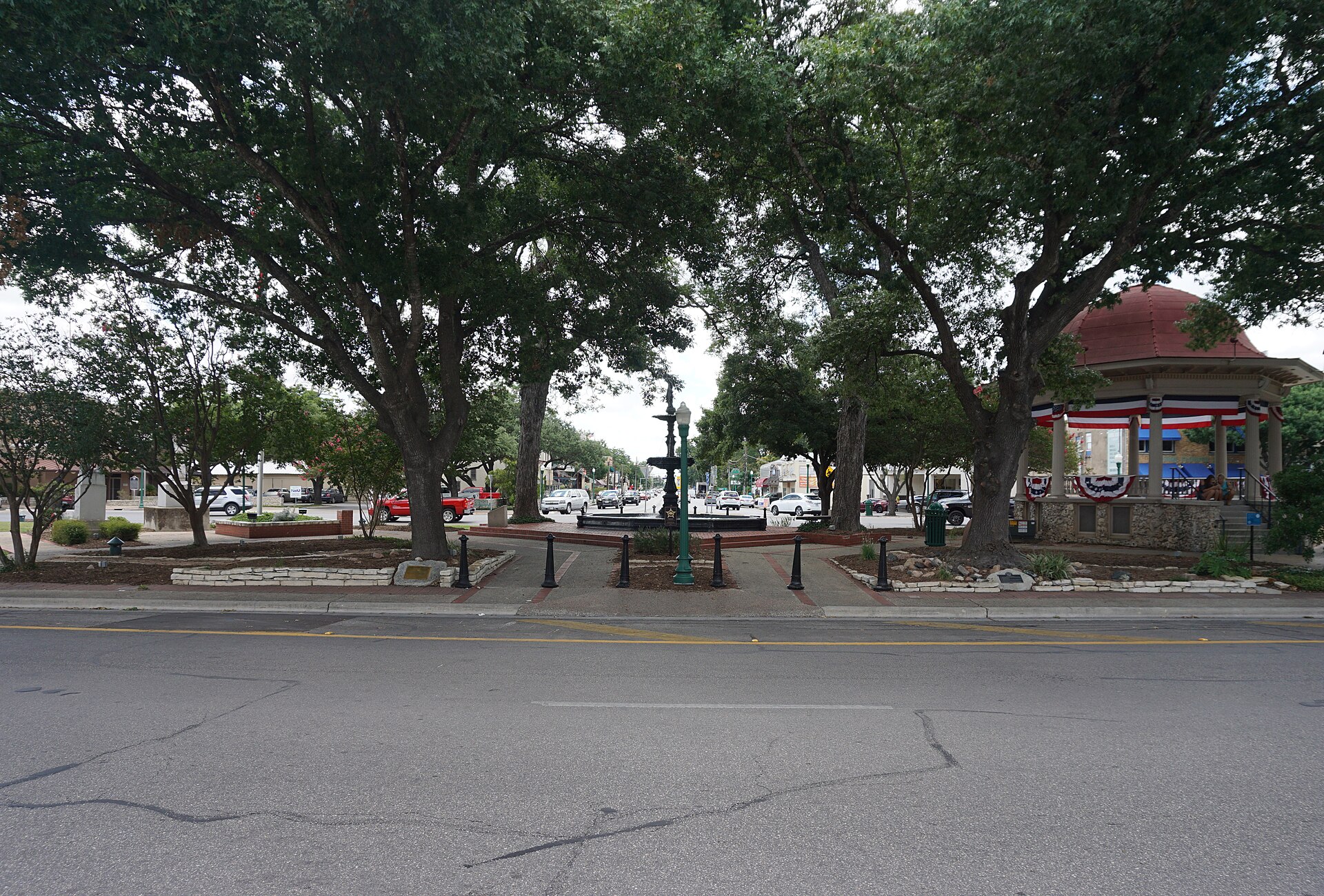
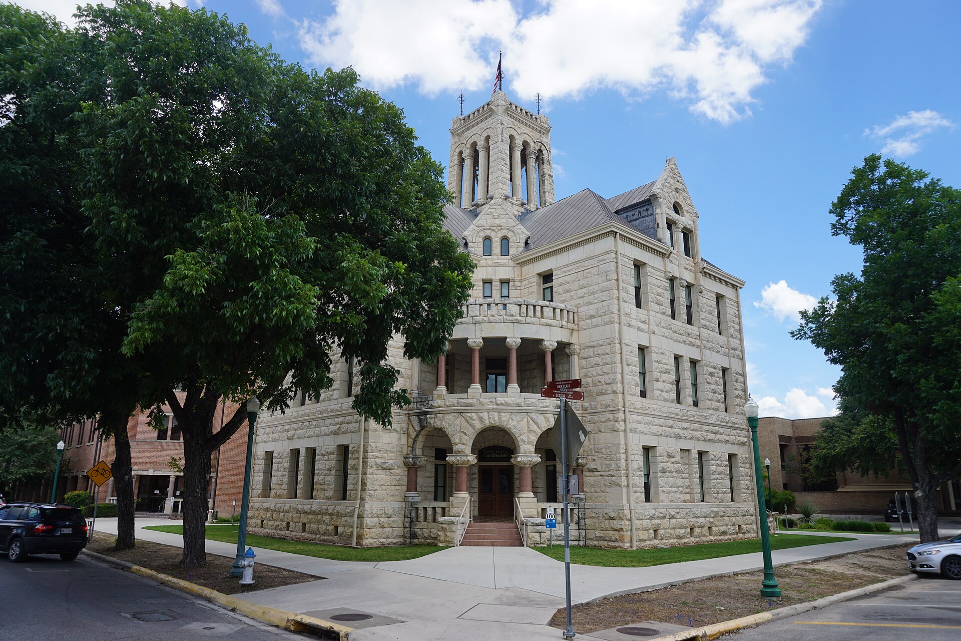
Downtown still carries the 1845 town plan. Main Plaza was not placed there accidentally. The surrounding streets, town lots and larger acre lots created a civic and commercial center whose pattern remains legible even when traffic circles the bandstand. Look past the German names painted for tourism and study the limestone, fachwerk traditions, storefront widths and later Victorian, Craftsman and Art Moderne buildings. They show a city changing rather than a village frozen in 1845.
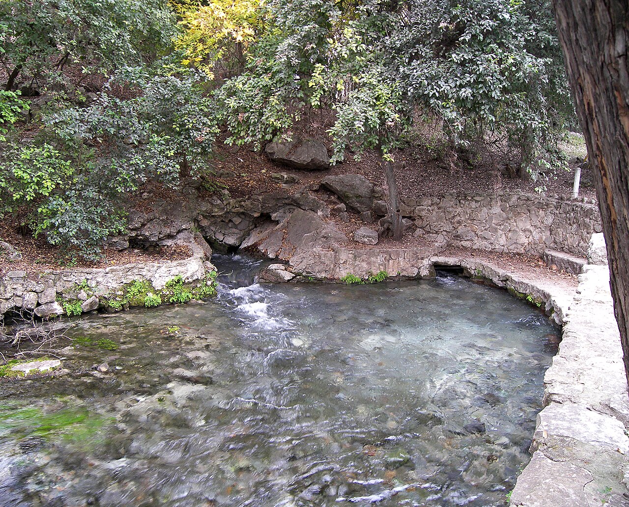
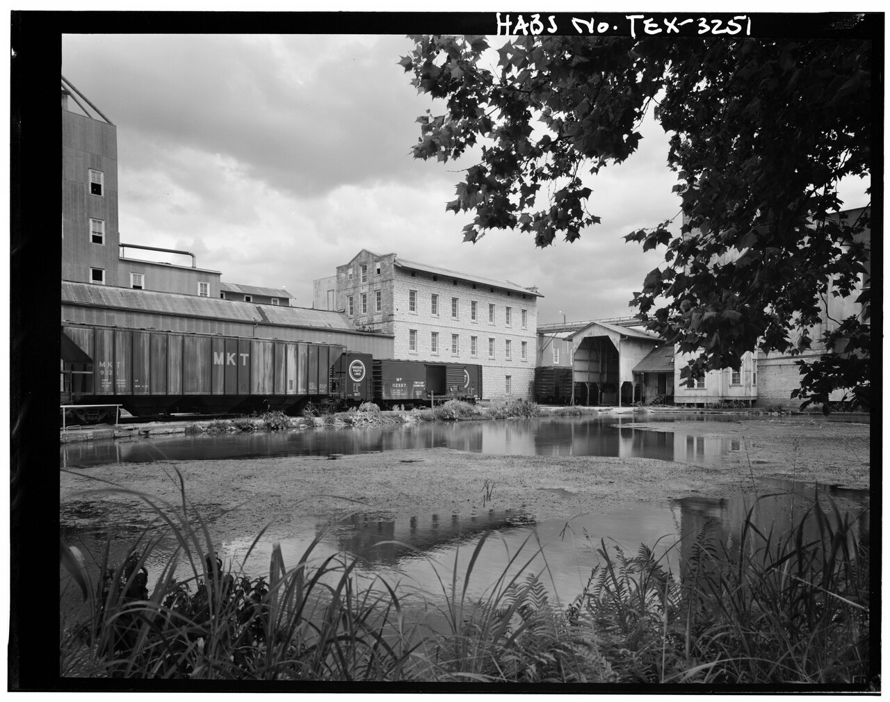
The beauty of Comal Springs can make the industrial story easy to miss. Water power made milling possible soon after the town’s founding. William H. Merriwether acquired the springs tract in 1847 and operated mills there. Joseph Landa bought the property in 1859. The surviving stone Landa Rock Mill was built in 1875 to replace an earlier wooden structure.
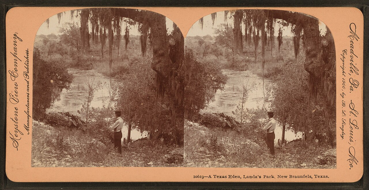
This was not a quaint mill turning slowly for visitors. It was part of the city’s productive economy. A 40-horsepower turbine drove the traditional millstones; when that technology became uncompetitive, Harry Landa installed a larger turbine and a Hungarian roller system in 1891. The spring landscape became public recreation in 1898, but it remained tied to private industry until later changes in ownership. The city purchased Landa Park in 1936.
German language, newspapers, schools, music, foodways and voluntary associations gave New Braunfels a distinctive culture that lasted well beyond the immigrant generation. The city should not be embarrassed by that inheritance or reduce it to beer and costumes. The more honest approach is to take it seriously while refusing to let it crowd everyone else out of the frame.
Black residents built families, businesses, congregations and mutual support under slavery, emancipation and segregation. Allen Chapel African Methodist Episcopal Church traces its congregation to 1890. The first Black Baptist congregation began in 1900 when fourteen founders met under a live oak; that community became Live Oak Baptist Church. These buildings matter because the institutions inside them helped people worship, educate children, organize, bury their dead and endure exclusions imposed elsewhere in the city.
The Freedman’s Section of Comal Cemetery deserves the same interpretive attention given to prominent German graves. A cemetery is not just a collection of stones. It is a record of who could purchase land, whose names entered official documents, which families maintained memory and which citizens were pushed to a separate part of the landscape.
Mexican and Mexican-American history in New Braunfels is older and richer than a festival weekend. West End grew as a place of homes, small businesses, schools, faith, baseball, dances and family networks. At West End Park and Dance Hall, the Delgado family created a community landscape that hosted weddings, anniversaries, quinceañeras, boxing, skating, carnivals and Diez y Seis de Septiembre celebrations. Lydia Mendoza—one of the great Spanish-language singers of the borderlands—performed there. Local teams first called the Cardinals and later the Lions played clubs from New Braunfels, nearby towns and Mexico.
The hall and ballfields are gone, which makes the story more important, not less. Preservation cannot be limited to buildings that survived redevelopment. Panteón Hidalgo, established in 1920 by the Asociación Mutualista de Beneficencia, and Our Lady of Perpetual Help Cemetery hold another kind of archive: the names of Mexican-American residents whose lives were often undercounted in civic records. Researchers have used census fragments, property records, obituaries, death records and the Morales Funeral Home collection to restore that history.
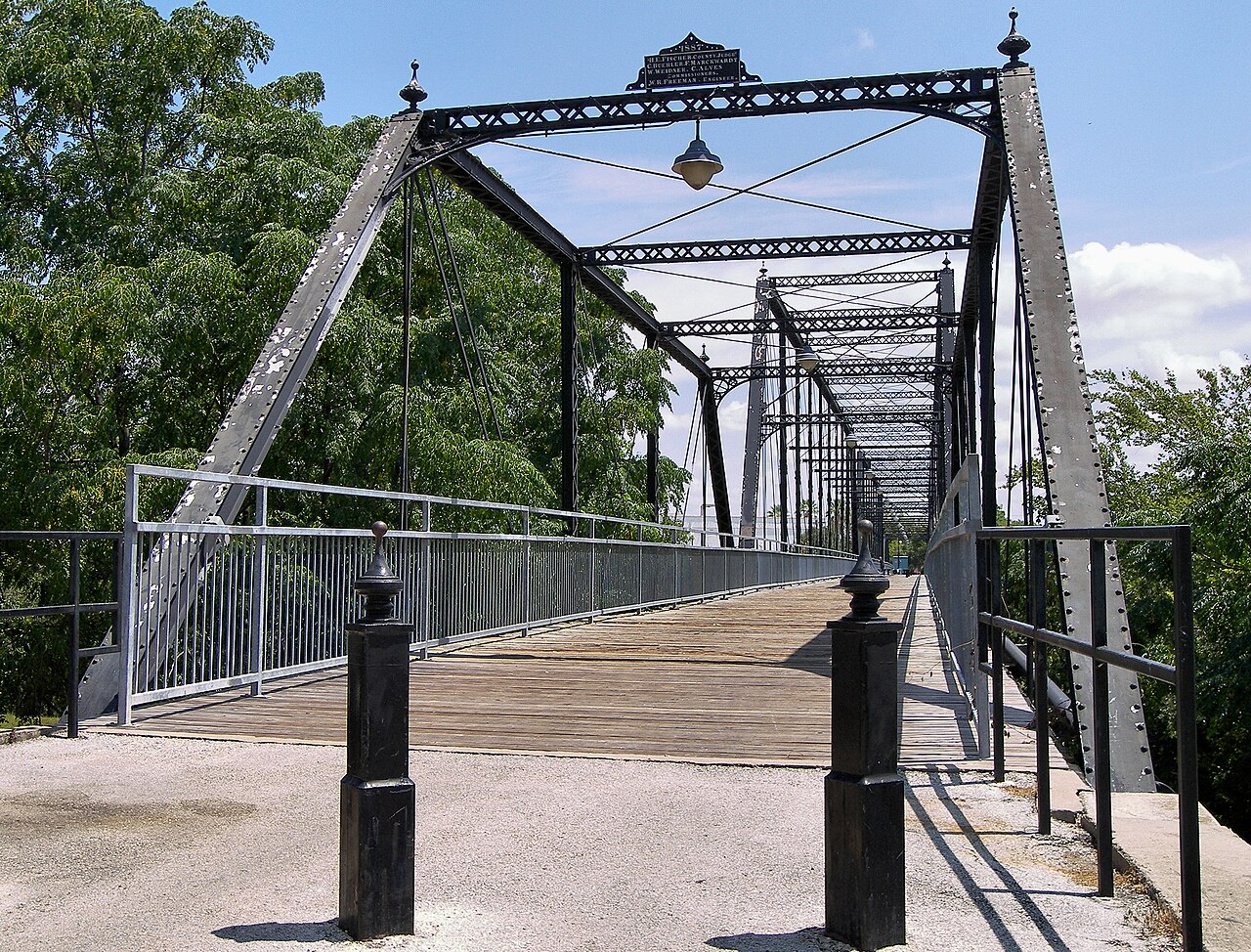
By the late nineteenth century, New Braunfels was no longer only the original settlement around the plaza. Mills, rail connections, warehouses and new neighborhoods pulled the city outward. The Faust Street Bridge, opened in 1887 as a toll bridge across the Guadalupe, belongs to that expanding commercial landscape. Today it is a pedestrian crossing and one of the best places to see how the Guadalupe cuts through the built city.
Stand there and look in both directions. The river is scenic, but the bridge tells you it was also infrastructure. That distinction matters throughout New Braunfels. Water powered mills, constrained streets, carried floods, drew visitors and created arguments over access. The rivers are not decorations around the history. They are active forces inside it.
Go early. Read the springs as Indigenous geography, municipal water, industrial power and public recreation—not simply as a pretty park.
Use the museum to understand the Adelsverein, the crossing in 1845, the migration crisis and the institutions settlers created after the colonial scheme broke down.
Walk rather than drive the circle. Look for the original plan underneath later architecture, then notice how civic memory has been curated.
Use the linked cultural features before visiting. These are living communities and sacred places, not props for a heritage checklist.
Finish where transportation, river geography and industrial growth meet. It is a stronger ending than rushing immediately to Gruene.
New Braunfels is growing along the I-35 corridor while marketing a nineteenth-century identity. That tension is now part of the story. Historic districts can protect architecture, but preservation also has to confront housing pressure, traffic, flood risk, tourism labor and displacement. A city can save a fachwerk wall and still lose the community that gave a neighborhood meaning.
My advice is simple: give New Braunfels its own day or at least a serious half-day. Do not use it only as the road between Gruene and Canyon Lake. Begin with the water, understand the German migration in full, follow the mills and bridges, and make room for Black and Tejano New Braunfels as living civic history. Then the city stops being a theme and becomes a place.
Pair the Comal or Landa Park with downtown, a museum or a neighborhood story and the city becomes much more than the waterpark version sold to visitors. I am not interested in a German-themed checklist that never asks what happened after settlement.
Realistic time6–10 hours
Cost postureMany public spaces are free; attractions and meals vary
Access realityHeat, downtown parking and river conditions affect pacing
Open the field map · Check current events · Check lake, river and weather conditions
Tony’s Guide separates documented history from interpretation. When a local memory and an official record differ, that tension belongs in the research rather than being quietly edited away.